



580 California St., Suite 400
San Francisco, CA, 94104
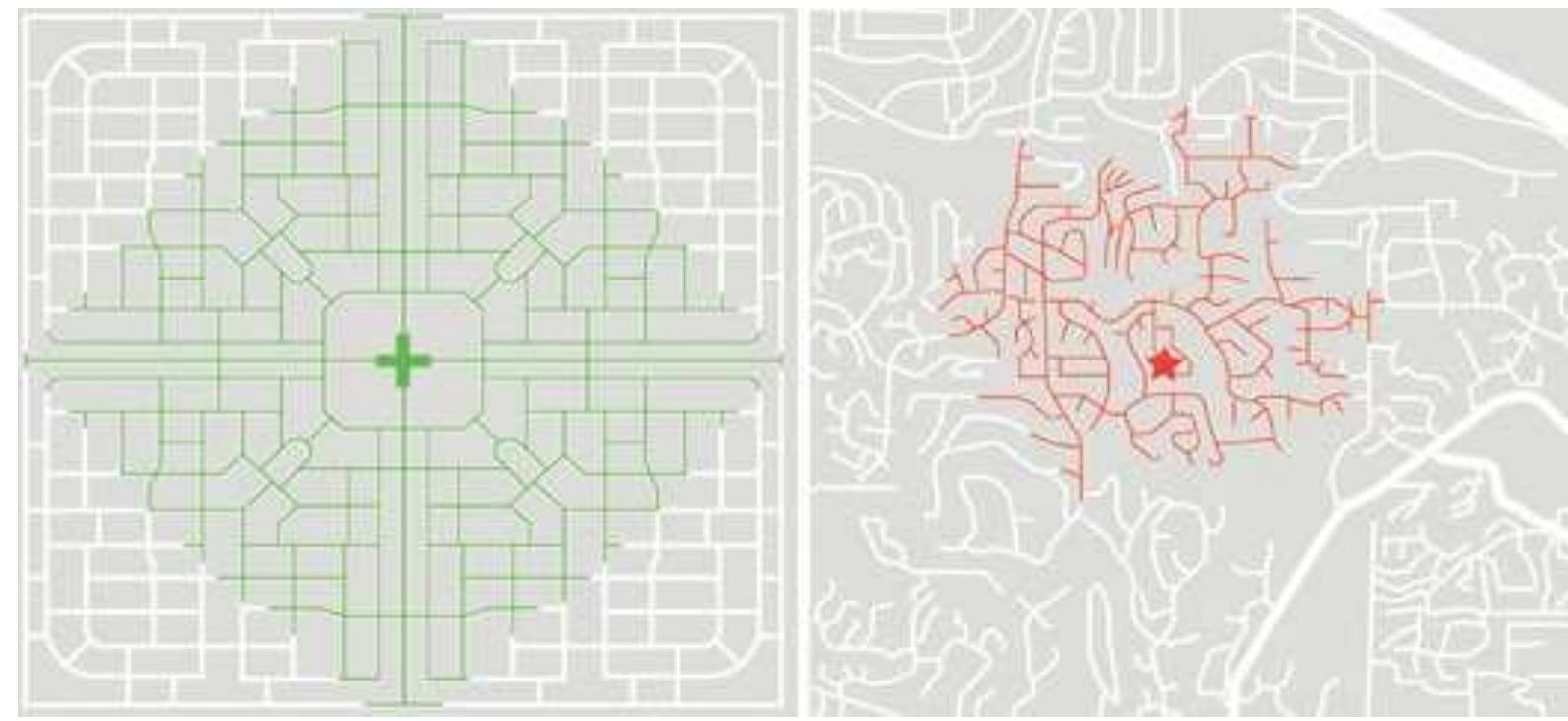
Comparison in 800-meter radius walking catchment in different street connectivity scenarios (compact grid vs. sprawling suburb).
Figure source:
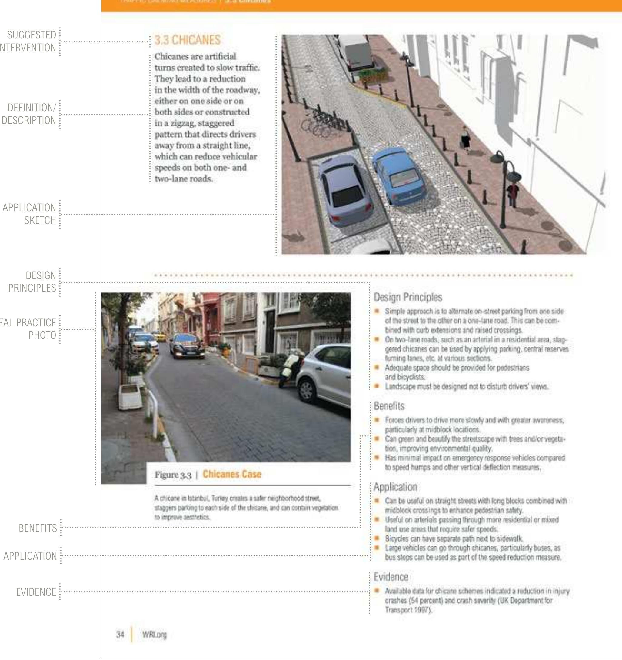
Abstract: Develop mixed land uses, smaller blocks, ground-floor activities, and nearby public facilities that reduce overall exposure to traffic crashes from less vehicle travel. Integrate proven measures such as speed humps, chicanes, chokers, refuge islands, traffic circles, shared streets, and other street design applications that can reinforce safety. Arterial corridors that ensure safer conditions for all road users Improve arterials and other main streets to ensure the safety of pedestrians, cyclists, mass transit as well as motor vehicle drivers through reduced crossing distances, lead pedestrian intervals, refuge islands and medians, safe turning movements, and lane alignments. Consistent designs should create a forgiving road environment with the least surprises for the road user, especially for vulnerable users. A Note on the Road-Testing Process Version 1.0 allows for a "road test" to work with designers, auditors, project managers, policy makers, and other stakeholders involved in the way streets and communities are designed. During this road-test period, we will learn how the guide can be applied in cities and complete a review to improve it further. This road test will include workshops, use in road safety audits and inspections, black spot (also known as hot spots, or high crash locations) treatment, and application to on-the-ground projects in coordination with city planners and officials. This process will occur across several countries and cities. It will seek out more examples that can explain real-world application of evidence-based measures, as well as additional evidence from different areas of the world to enhance the global understanding of safer design. Those interested in providing feedback, examples of good practices, and evidence can contact the project team through our email address:
