

 Alastair Northedge

580 California St., Suite 400
San Francisco, CA, 94104
2022, The Historian of Islam at work, ed. van Berkel & Osti
https://doi.org/10.1163/9789004525245_013…
29 pages

An attempt at evaluating the population of Samarra under the Abbasid Caliphate.

AI
Journal of Abbasid Studies, 2025
This paper approaches the city of Samarra through one of its most fundamental attributes - the water supply. In seeking to understand how water was transported to, and distributed throughout, the vast metropolitan area, as well as the significance of the various pieces of hydraulic infrastructure required for this task, new light is shed on the occupation of the short-lived Abbasid caliphal capital, the priorities of its rulers, and the lives of its inhabitants.
Der Islam, 2022
In this paper we will show how Qurashī patrilines and marriage records can be statistically analysed to generate an estimate of the tribe's size at the time of Muḥammad. By extension this will also give us an estimate for the population size of Mecca. We will begin by using the marriage data preserved in a genealogical work to identify a cohort of adult Qurashī male contemporaries of Muḥammad. We will then divide this cohort into men who had brothers versus those who did not. It will be shown that this ratio is exactly what we would expect if we were modelling a complete population and therefore it cannot be a sample. With this in place we can extrapolate the number of women and dependants that would have been linked to each man, giving us an estimate of the tribe's size in the period. Supplementing this with selected historiographical data will give us the population size of Mecca. The resulting findings raise a series of questions concerning Qurashī origins that will then be addressed by applying a similar methodology to the eras before Muḥammad's. This will illuminate the manner and timing of the emergence of the Quraysh as a distinct entity.
At the Dawn of History: Ancient Near Eastern Studies in Honour of J. N. Postgate
Le Proche-Orient de Justinien aux Abbassides: Peuplement et dynamiques spatiales (Bibliothèque de l'antiquité tardive, 19) A Borrut, M Debié, A Papaconstantinou, D Pieri, 2011
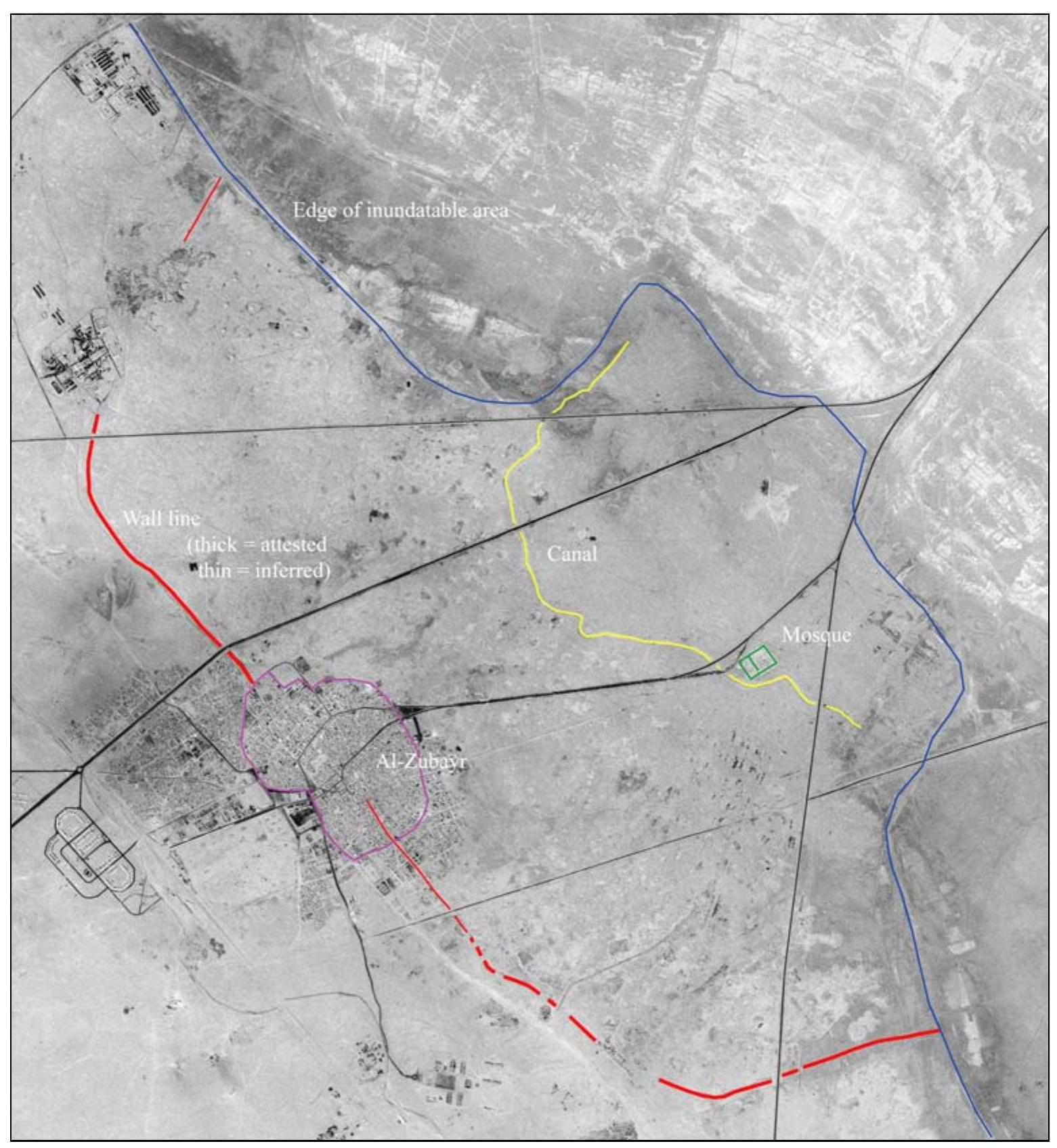
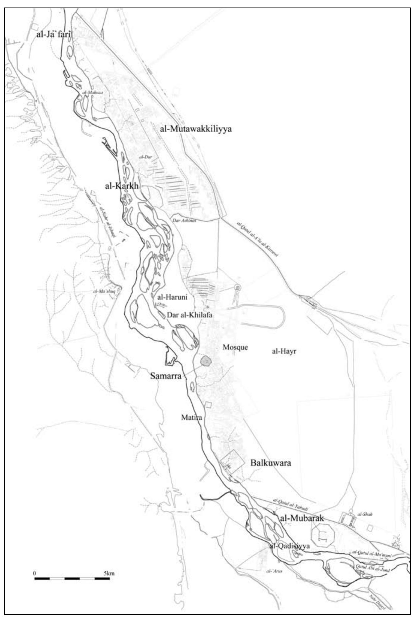
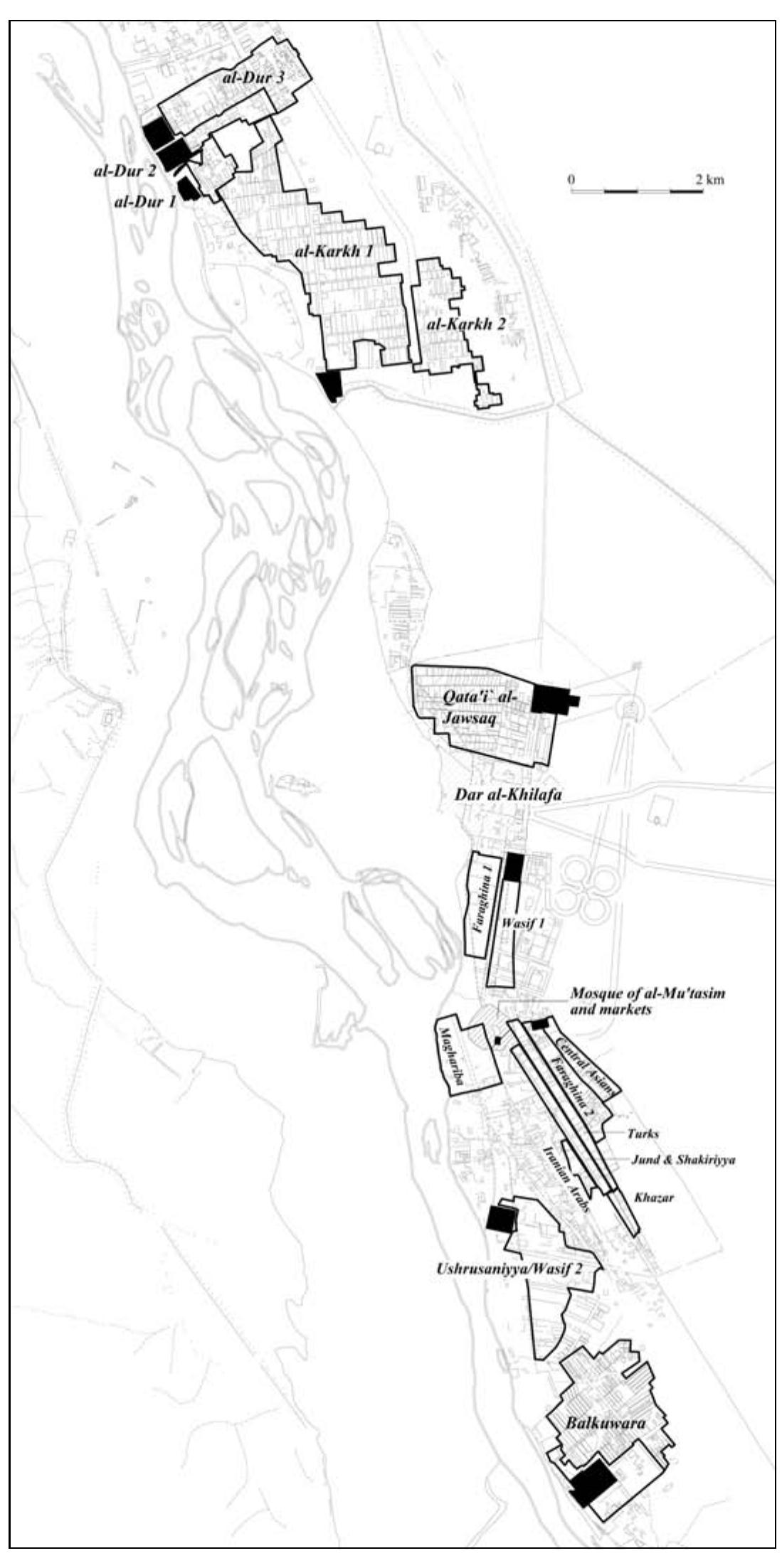
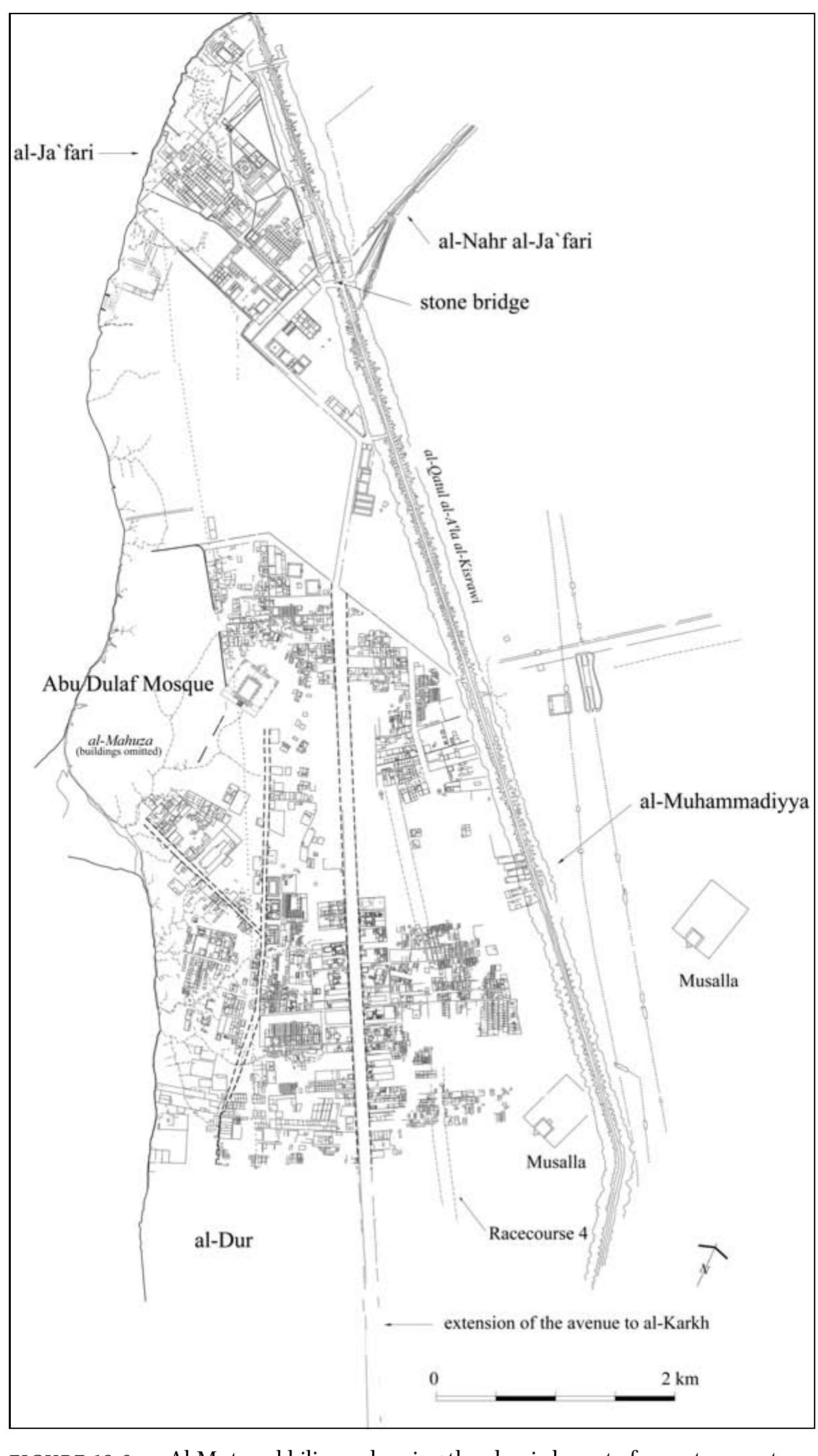
Contrairement à ce que l'on écrit souvent, il y a peu de preuves décisives que les Abbassides aient tenté de copier les Sassanides dans leur mode de gouvernement. L'occupation de Samarra par les souverains sassanides et les califes abbassides illustre bien les rapports entre l'héritage sassanide et les choix des califes abbassides. Samarra, qui suscitait peu les résidences avant l'époque sassanide, exerce soudain un fort attrait à la fin de la période sassanide. Il se prolonge à l'époque abbasside. Ce choix s'explique par le creusement d'al-Qāṭūl al-Kisrawī, le nouvel accès au réseau de canaux de Nahrawān qui capte l'eau du Tigre au-delà de la plaine alluviale mésopotamienne. Il fut choisi pour cette raison comme terrain de chasse royal par les Sassanides qui y élevèrent une tour commémorative, un palais dont les salles d'apparat s'étendaient entre un vaste réservoir et le Tigre ainsi qu'un parc de chasse. Ces installations étaient exclusivement réservées au souverain mais les nouveaux canaux stimulèrent l'économie agricole à l'Est de Baghdad et firent espérer au gouvernement une augmentation de ses ressources. À l'époque abbasside, différents souverains intervinrent à Samarra. Hārūn al-Rashīd fit aussi creuser, comme les souverains sassanides, un nouveau canal (Qāṭūl Abī al-Jund), parallèle et à l'ouest du Qāṭūl inférieur. À la manière sassanide, il fit construire un monument commémorant ce creusement, l'Octogone de Qādisiyya, orienté vers la qibla. Seules les murailles de ce nouveau site furent achevées. Trois avenues convergeaient vers une place centrale dans laquelle devait prendre place une mosquée. Contiguë à cette place, une seconde surface rectangulaire correspondait sans doute à un palais. Le site était une réplique parfaite de la Cité Ronde de Baghdad, bâtie trente ans auparavant mais avec certains changements : la place centrale notamment était occupée par la mosquée et non plus par le palais. Les sources hésitent, pour la qualification du site, entre ville (madīna) et palais (qaṣr). La taille du site semble indiquer que le calife avait eu l'intention d'y résider et d'y héberger, comme à Baghdad, une partie de l'armée. Le calife al-Ma'mūnī construisit un canal prolongeant celui de Qāṭūl, mais le projet se révéla catastrophique : le nouveau canal, creusé trop près de l'ancien, entraîna l'effondrement de l'espace les séparant et détourna peu à peu le Tigre de son ancien cours. Enfin, un dernier calife, Al-Mu'taṣim, voulut habiter Samarra avec pour raison principale la chasse, mais aussi le souci d'y loger la cour et une base militaire. À la différence de l'armée sassanide qui prenait ses quartiers en province, l'armée abbasside tenait les siens dans les capitales, Baghdad et Samarra. La nouvelle cité, Surra Man Ra'ā, fondée en 221/836, comprenait un palais califal et une avenue longue de sept kilomètres, avec une seule inflexion à l'emplacement des marchés et à proximité de la première mosquée de la communauté, qui fut plus tard remplacée par celle de al-Mutawakkil avec son minaret en spirale. Mis à part la mosquée et les marchés, presque tout le site était occupé par les cantonnements de l'armée. Les maisons des secrétaires et d'autres personnages de l'élite civile, qui s'étaient regroupées autour de la première mosquée constituaient toutefois une exception importante. En outre, deux bourgades furent établies à une certaine distance, le cantonnement des Turcs et celui des Sogdiens. À l'Est de la cité un parc entouré d'un mur en terre, al-Ḥayr, fut aménagé. Ce parc ne fut pas une réussite car ses murs étaient situés en bordure orientale de la ville de Surra Man Ra'ā, interdisant toute expansion de la ville. Il fut abandonné et sa superficie occupée par trois champs de course et deux muṣallās. Al-Mutawakkil (847-861), le plus important bâtisseur à Samarra, remplaça le parc détruit par deux autres, situés au sud, autour de l'Octogone, sur chaque rive du Tigre. Plus tard, quand, en 859, il entreprit de construire la nouvelle cité royale d'al-Mutawakkiliyya, il se rapprocha des usages sassanides en reconstruisant le palais sassanide et le parc au nord de Qāṭūl. Cette entreprise fut de courte durée car Al-Mutawakkil fut assassiné deux ans plus tard et al-Mutawakkiliyya abandonnée. La chasse dans la Samarra abbasside était-elle aussi ritualisée que celle qui est décrite sur les reliefs de Khusraw Parvīz à Ṭāq-i Bustān ? Les livres de chasse ne mentionnent jamais ce style de chasse et préfèrent insister sur la fauconnerie et la chasse avec chiens. Le type de chasse pratiqué rappelle plutôt celui qui est évoqué à Quṣayr ʿAmra qu'à Ṭāq-i Bustān. Il semble que les Abbassides choisirent Samarra pour la même raison, la chasse. Après l'abandon de la cité par les califes, Samarra perdit sa prééminence, même si elle resta célèbre comme ville du siège des 10 e et 11 e imams des Shiites. Durant la période sassanido-abbasside, Samarra fournit un bon exemple de l'étendue avec laquelle les Abbassides suivaient ou non celles de leurs prédécesseurs sassanides. Les deux choisirent Samarra pour défendre leur royauté. Il semble donc qu'à Samarra les Abbassides qui avaient hérité de la tradition des parcs de chasse sassanides les aient utilisés de manière différente. La première conclusion que suggère le matériel de Samarra est la survie des traditions et pratiques sassanides, plutôt qu'une référence délibérée à l'identité sassanide. Les Abbassides n'avaient aucun intérêt direct pour le nationalisme iranien. Ils continuèrent à répandre le système de Qāṭūl, parce que c'était la tradition existante. De la même façon, les parcs de chasse furent aménagés suivant la tradition la plus récente, même si cela ne correspondait point aux nécessités abbassides.
Journal of Religious Minorities under Muslim Rule 2, 1-27, 2024
This article examines the testimony of the Arabic Samaritan Chronicle to examine the lachrymose account of the decline of the community. It compares this narrative to those of contemporary Christian sources and argues that the impression of crisis is appreciable worse than for most Christian populations. This rests in part on the small size of the Samaritan population, which made it vulnerable to natural disasters, and its separation from a wider Mediterranean diaspora, which might have allowed the community in Samaria to generate resources. It further argues that the strict exclusion of non-Samaritans made collaboration with Muslim authorities very hard for Samaritan leaders, which reduced its flexibility in dealing with authoritarian structures that might change rapidly.
Jerusalem Studies in Arabic and Islam, 2000
ASPECTS OF THE TRANSITION FROM TI3E UMAYYAD TO THE 'ABBASID CALIPHATE* A. Introduction Until the late 1960s, Islamic historians, particularly those of the early 'Abbasid period, presented the "'Abbasid Revolution" as an Iranian nationalist revolution. From its inception the ' AbbBsid Caliphate was portrayed as an "Islamic Caliphate," based on the predominance of the Iranian ethnic elements in sharp contrast to the "Umayyad secular Arab Kingdom ." ' The studies by Dennett2 and A y a l~n ,~ and especially those by Sharon and Omar, showed that the "'Abbasid Revolution" relied primarily on the Arab tribes of Khur&s&n (mainly of southern origin),4 which constituted the backbone of the 'Abb~sid army, Ah1 Khuriisiin and their descendants, al-A bnii' or A bnii' Ah1 Khur~siin.~ Even though Sharon's and Omar's studies were already published in the late 1960s, their findings were either ignored or not sufficiently talren into account in more recent studies on the early 'AbbBsid state. These studies refer to the "'Abb8sid Revolution" as mainly Iranian, and *Parts of this paper are based on my Ph.D. dissertation, "Characteristics of the Development of the 'Abbaid Army (Especially Ah1 Khur&Sn and al-AbnS' Units), with an Emphasis on the Reign of al-Amin and al-Ma'miin",
Muqarnas Online, 2008
BASOR, 1992
JSTOR is a not-for-profit service that helps scholars, researchers, and students discover, use, and build upon a wide range of content in a trusted digital archive. We use information technology and tools to increase productivity and facilitate new forms of scholarship. For more information about JSTOR, please contact [email protected].
Journal of Material Cultures of the Muslim World, 2023
This article discusses recent fieldwork at the site of early Islamic Basra which is located 15 miles to the south-west of the modern city.
This paper aims at analyzing the social and political conflict between the different tribal groups within the Umayyad rule and to establish a link between the Islamic values adopted by some of the Umayyad Caliphs and the `Abbasid Revolution. One of the particular concerns of this paper is to see the changes following the `Abbasid Revolution’s victory, mainly the complete assimilation of all members of the Muslim community, Arabs and non-Arabs into the empire. The transfer of the Islamic capital from Damascus to Baghdad had its significance namely the intersection of several trade-routs which could give real prosperity to the `Abbasid empire, and subsequently led to the remarkable rapid spread of Islam among the non-Arabs in the east and the far-east including the Malay Archipelago. The remarks in this paper are intended to present a new picture of conclusion reached in a more detailed study of the `Abbasid Revolution, conclusions which are based on evidence contained in the earliest Arabic sources available to us. Keywords: Social, Politics, Abbasid, Khurasan, Revolution
AI
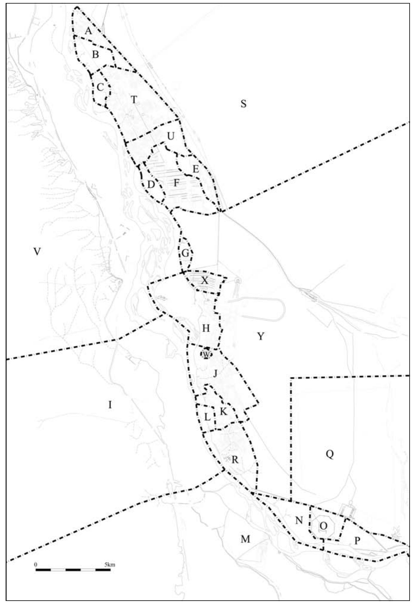
Research indicates a maximum population estimate of 204,868 during al-Mutawakkil's reign, potentially 164,034 without his short-lived urban project.
Samarra's layout features a main avenue over 7 km long with a dispersed population, unlike Baghdad's more compact design.
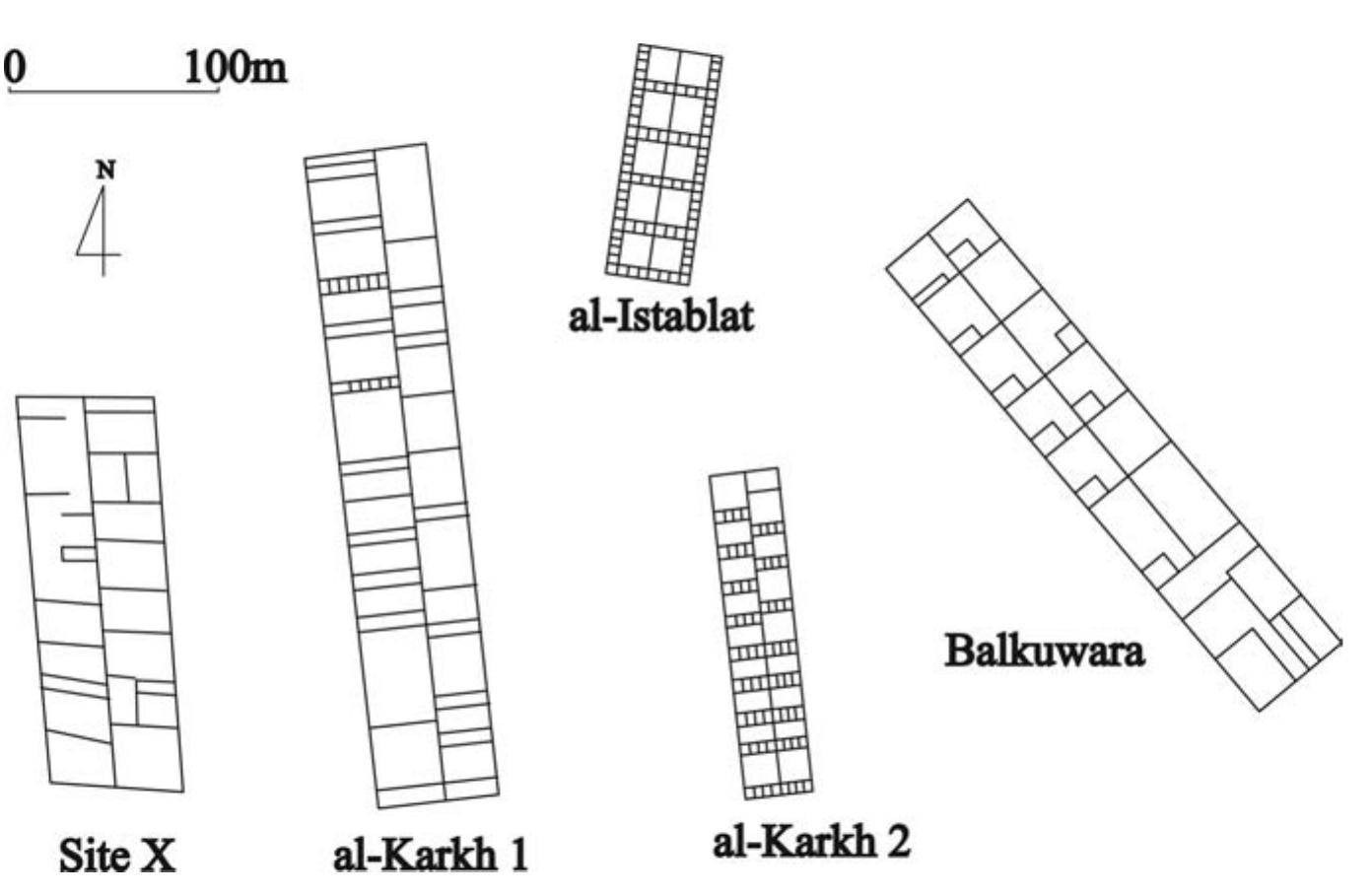
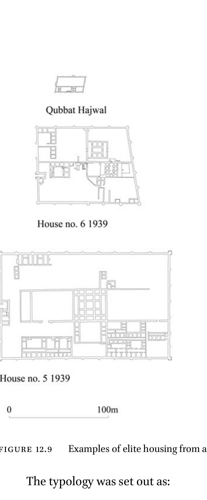
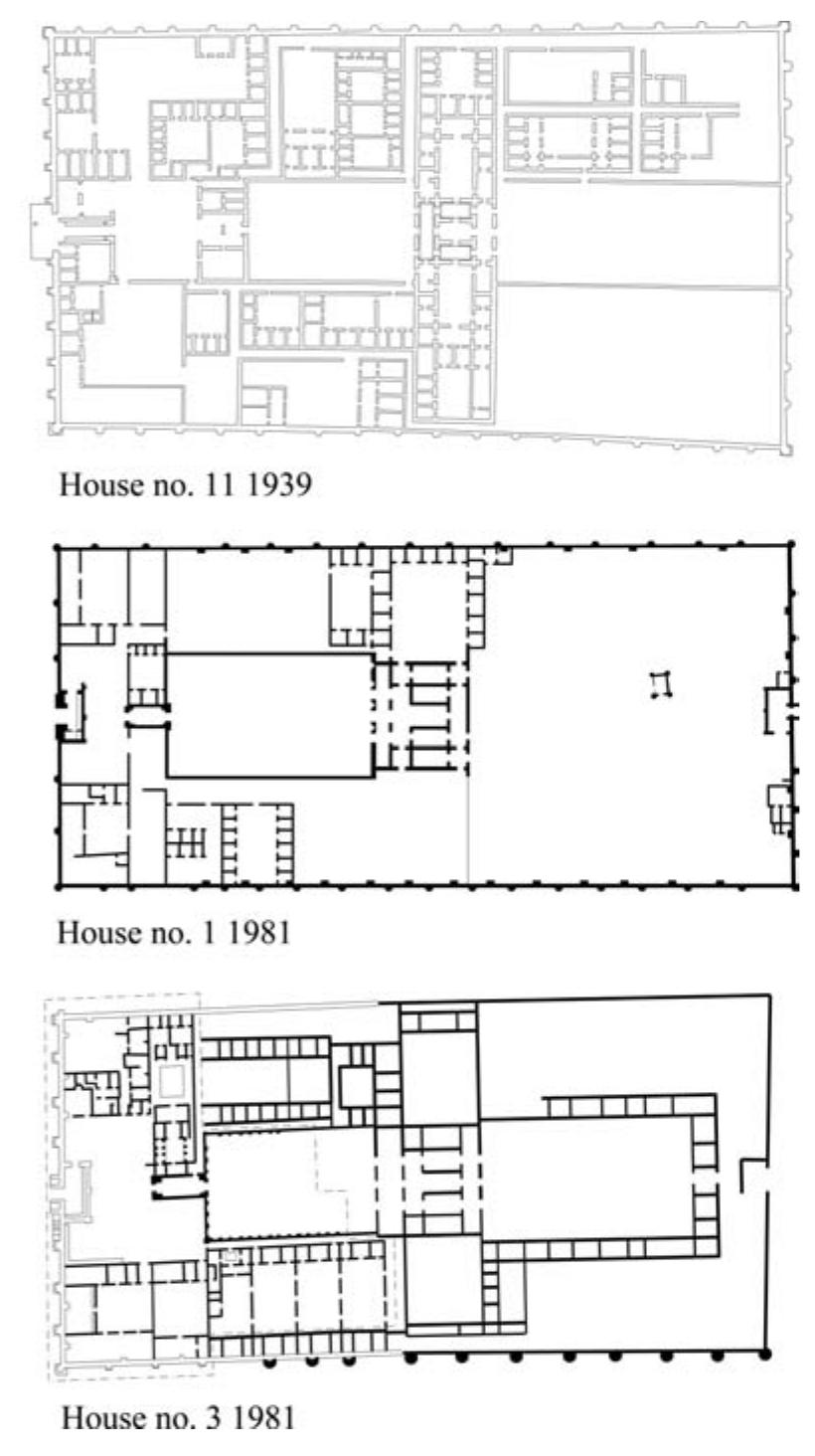
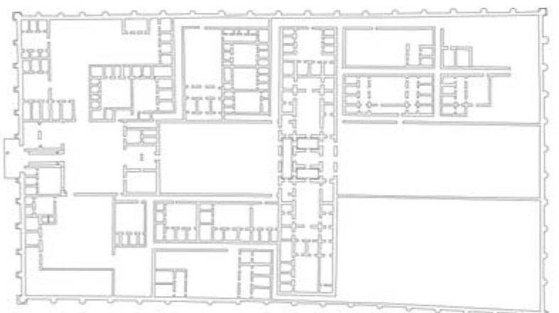
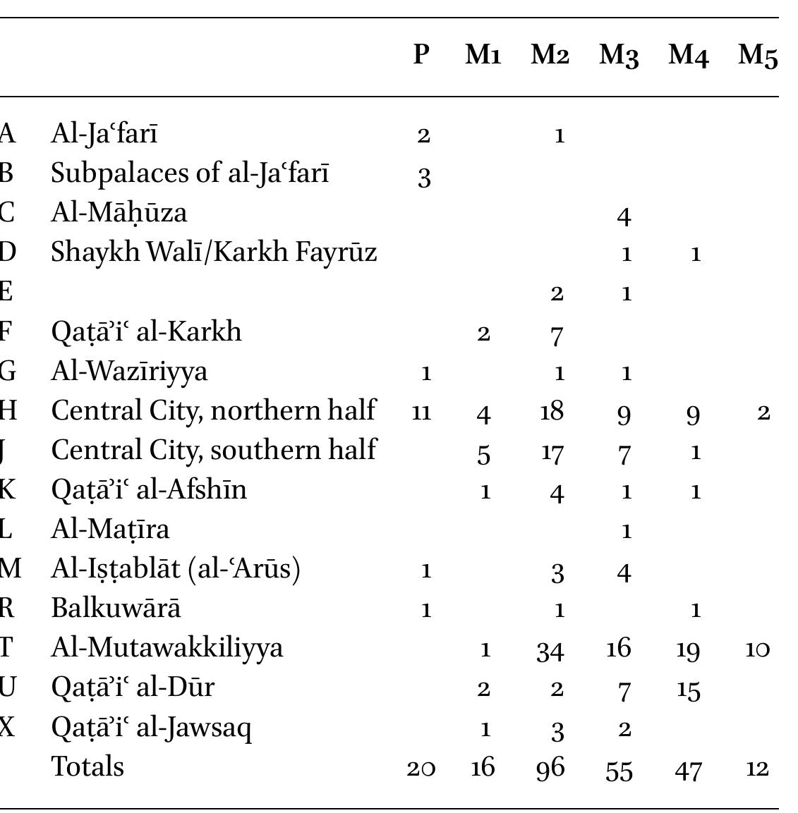
Cantonment structures and palace sites suggest a significant urban density, with 289 elite residences housing potentially 48,300 inhabitants.
Estimates rely on spatial calculations of urban density and architectural capacities, as seen in mosque areas accommodating up to 60,000 males.
Military cantonments, housing up to 12,000 soldiers, incorporated families, thus complicating population density estimates across residential units.

Beiträge zur Islamischen Kunst und Archäologie, 2014
Evaluation of the development of the city-centre of Abbasid Samarra (836-892)
AlMuntaqa ,Published by: Arab Center for Research & Policy Studies, 2019
This study introduces the stages of the development of quantitative history through its main scholars and schools, then presents some statistical innovations and methods to estimate the inhabitants and populations of some Islamic cities throughout history, using a number of Arab and Western studies. This research has relied on quantitative approaches, demographic theories, and sought to utilize old texts and the statistical inferences found throughout these texts. The study also employs mathematical inferences that can be drawn from the spacial dimensions of these cities and the number of their public facilities, in as much as these inferences provide indicators of the dynamics of population size and growth in these cities. These quantitative approaches are certainly an important addition to the study of the history of Islamic societies. However, their systemic gaps reveal their limits and their relative nature. The utilization of these kinds of quantitative approaches can be risky if they are not historically and cognitively situated. This caution is in no way an attempt to dismiss these quantitative approaches, but rather a call to strengthen them using a more cautious and controlled approach.
1978
The bases of the present dissertation from the point of view of the sources are historical and biographical. The study of the people of al-Qayrawan, which is largely dependant on the study of the Tabagat, has been carried out with a view to discovering as much as possible about how people lived and earned their livelihood. Against this background the question of the numerical size of the population has, been considered. Work on this dissertation has involved spending inter alia four months in North Africa in 1974. This took me to Egypt, Tunisia, and Morocco. Most of that time was - spent in Tunisia, where on the one hand I was looking for the manuscripts relevant to al-Qayrawan, and on the other collecting material towards helping to establish the early mediaeval plan of al-Qayrawan. At the same time I made the facsimiles and, took the photographs for the collection of the monumental inscriptions which constitute part of the material for this work. During my stay in al-Qayrawan and ...
A Medieval Islamic City Reconsidered, Oxford Studies in Islamic Art 14, 2001
A review of the various palaces at Samarra, at leas those attributed to the Abbasid family. Northedge, A., The palaces of the ‘Abbasids at Samarra, in Robinson, C. (ed.), A Medieval Islamic City Reconsidered, Oxford Studies in Islamic Art 14, Oxford, 2001, 29-67.
"Probably built on the site of an ancient village named Diriditis, Baṣra was certainly re-styled under the Sassanid when was called Vahishātābadh Ardasher in honour of the Shahanshah from which took his name; under the ‘Arabs, Baṣra was appointed probably from Basāra which in Arabic means: acutely aware, perspicacity, possessing knowledge or understanding, a name that could not have been more appropriate. During the VI century Baṣra was already inhabited by ‘Arab Bedouin clans not specifically in the urban area but probably in the surrounding region, which is geographically settled close to the desert but immersed in a marshy area which would be nicknamed the Shaṭṭ al-῾Arab. Founded under ‘Umār ibn al-Ḫaṭṭāb, the establishment, at the beginning, was attributed to Sa‘d ibn Abī Waqqāṣ, a companion of the Prophet and a military general, the winner of the Qādisiyya battle; however, in the Early Islamic age, the conflict between Baṣra and Kūfa, for the allocation of their respective date foundation and the prestige of the founder, encouraged us to acknowledge that the truly maker of the first military camp was the Prophet’s companion ‘Utba ibn al-Ġazwān in 638/17: “this city was founded in the lower part of Iraq, on the great river formed by the junction of the Euphrates and Tigris. The city was intended to protect the region conquered by the Muslims about the mouth of Euphrates, to cut off the trade with India from Persia and to keep a check upon Ahwaz (a part of Ḫūzestān). […] The city of Baṣra was founded in the fourteen year of the hiğra. It soon gathered within its walls great numbers of inhabitants from the surrounding country; rose rapidly in importance, and has ever since been distinguished as a part for the Indian commerce.” The main problem concerning the first decade after Baṣra’s foundation was to provide, at his inhabitants, drinking water; the closed presence of the sea and of the desert doesn’t permit to find potable water. This difficulty would be resolved using the Tigris as main resource and building different water tank to collect also the rainy availability. Other difficulties concerned the construction of a port in spite of too low aquifers. At the beginning, Baṣra was exclusively a military camp and city, able to afford the control over the route of the Persian gulf and to constitute a starting base for the subsequent expeditions to Iṣṭaḫr, Fārs, Ḫurāsān and Sidjistān (29/650). Ṭabarī evaluate in 40.000 the baṣrian army which would fight in Ḫurāsān during the VII and VIII centuries. At the same time this city contributed to be settlement of Bedouins tribes who set off to urbanize. Before the ‘Arab arrival, the region was probably populated by Aramaeans, a semitic- ‘Arab population earlier emigrated in the north (they are usually associated with the Nabateans and the builder of Palmyra reign). During the Islamic conquest five ‘Arab tribes reached the city: Ahl al-‘Āliya, Tamīm, Bakr b. Wa’īl, ‘Abd al-Qays and Azd. It is possible that Tamīm clan dominated preserving an independent task during the internal early Islamic clashes. The process of sedentarization of a clan system, fortified the chiefs authorities of each clan maintaining autonomy and self-governing. The main settling reasons are probably connected with the Bedouin’s recruitment in the army and their avarice and money dependency: to be enrolled into an army created a money- dependency on the well paid salary of this historical period of conquering; ‘Arabs merchant, in addition, after the commercial decay of Arabian Peninsula, probably emigrated north and reached the towns of Kūfa and Baṣra. The chiefs upheld the order and created an internal aristocratic – familial system. Ch. Pellat in Le milieu baṣrien et la formation de Ğāhiẓ, lists a number of family authorities as al-Muhallab, Muslim ibn ‘Amr al- Bāhilī, Misma‘, al-Ğārūd, al-Anhaf ibn Qais, which represents the political most relevant figures of a first develop bourgeoisie."
Abstract: In 1911 Ernst Herzfeld excavated a handful of Arabic papyri and papers in the ruins of Samarra, the 9th c. capital of the Abbasid caliphs in what is nowadays central Iraq. Although partly published as photographs in 1948, they have never been adaequately studied let alone edited. They significantly enlarge the Arabic papyrus corpus, though, and for the first time bridge the “Mesopotamian gap” in Arabic documentation. The texts presented in this paper are object of a full edition under way.
UCLA Historical Journal, 1983
formations discussed had already taken place. The historical validity of the interpretation presented is therefore rather limited.
Residences, Castles, Settlements. Transformation Processes Between Late Antiquity and Early Islam in Bilad al-Sham. Edited by K. Bartl & A.R. Moaz, Rahden (OrA 24)., 2008
This critical review examines the article called as ‘An interpretation of the palace of the Caliph at Samarra (DAR AL-KHILAFA OR JAWSAQ AL-KHAQANI)’ written by Alastair Northedge.
Tribal Composition and Settlement of Arabs at al-Kūfah from the Conquest of Iraq to the end of the Umayyad period (632-750AD), 2024
The historical accounts of early Muslim period clearly relate traditions confirming the existence and role of several Arab tribes at al-Kūfah however it is difficult to make a demographic assessment of the numbers of tribesmen who settled through these historical accounts. The present research has made a quantitative study of the biographies of important people recorded by Ibn-i-Sa‘d to find out the demographic structure of the tribes at al-Kūfah and to see any increase or decrease in their numbers from the initial to the later period of migration. The study also explored the possible factors for the migration and settlement of these tribes towards al-Kūfah. The methodology adopted for this study is to count the number of individuals of each tribe in each ṭabaqa according to their nasb from the 6th volume of Ṭabaqāt-al-Kubrā of Ibn-i-Sa‘d . After counting, six broader categories have been formed in order to analyze the changing nature of migration and settlement of different tribes. Besides, the findings of the study have been extensively supported by the narrative accounts of the Muslim history in order to draw a historically more accurate conclusion.
